Florida’s coastline is protected in many places by barrier islands. These islands are generally long and narrow and are separated from the mainland by a narrow lowland area. This lowland can take the form of a lagoon, a marsh, an estuary, or a combination of these. Occasionally, a peninsula may be long and narrow enough to be considered a barrier island.
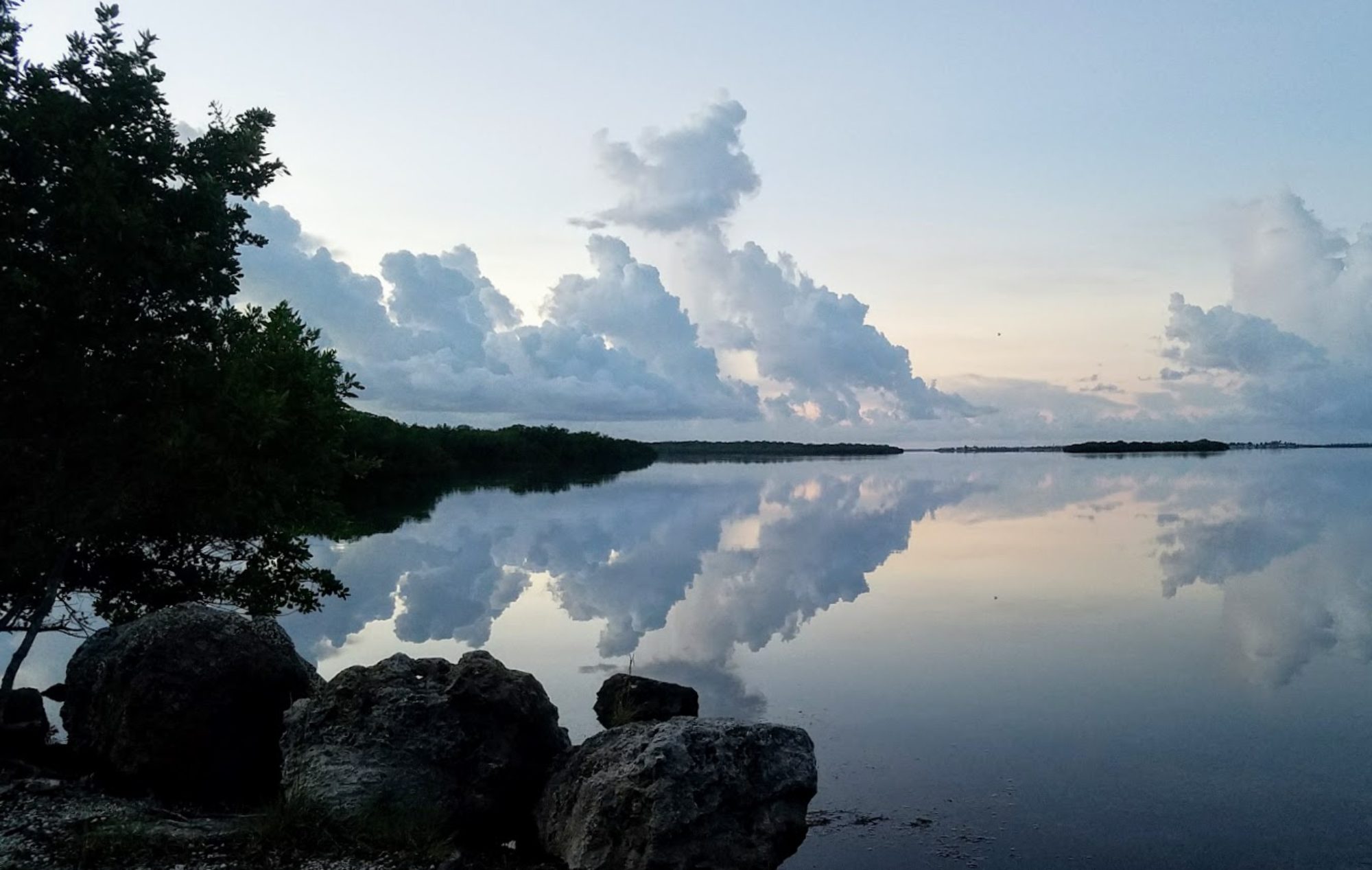
Our recent trip to the Florida’s panhandle put us on three barrier islands that highlight the variety and beauty of these coastal protectors. We visited St. Andrews State Park (partially situated on a peninsula), Dr. Julian G Bruce St. George Island State Park, T.H.Stone Memorial St. Joseph State Park at Cape San Blas (another peninsular barrier island). All of these parks are known for their crystalline green water, but we arrived right after Hurricane Sally and the water was not beautiful. It looked like any north Florida Atlantic beach, and the water was too rough to allow swimming.
Waves and currents, tides and storms, all of these work to shape barrier islands, and rising sea levels also have an impact on not only water color but on the physical shape of the islands. As sea level rises, the barrier islands tend to move closer to the mainland. Storms can punch through islands, creating new inlets, or they may remove one end of an island or scrub plant life out of the dunes with storm surge.
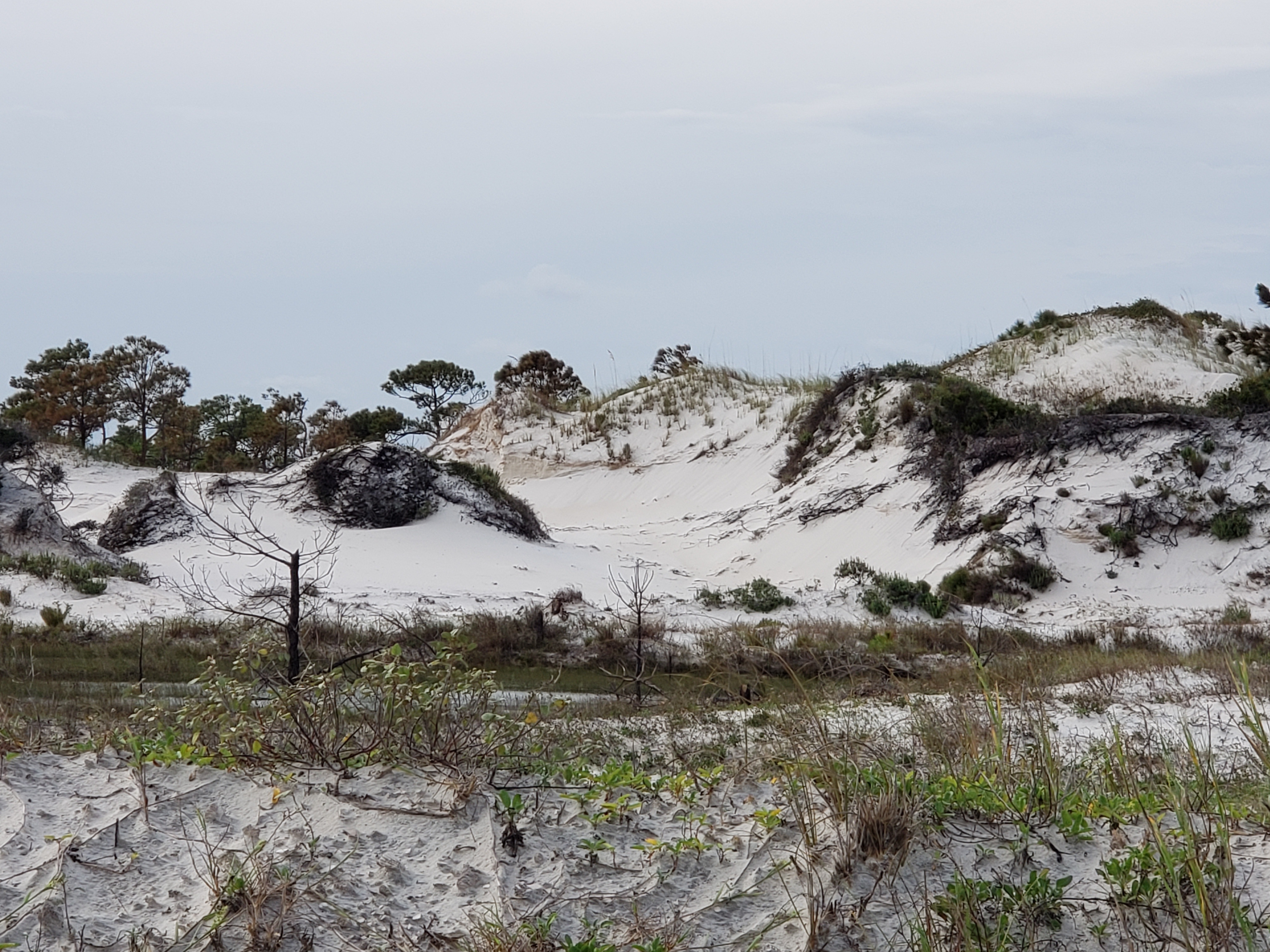
Barrier islands are made up of several different zones or habitats. These include the beach, dunes, mudflat or overwash, and a salt marsh. Waves and currents, tides and storms, all of these work to shape barrier islands, and rising sea levels also have an impact.
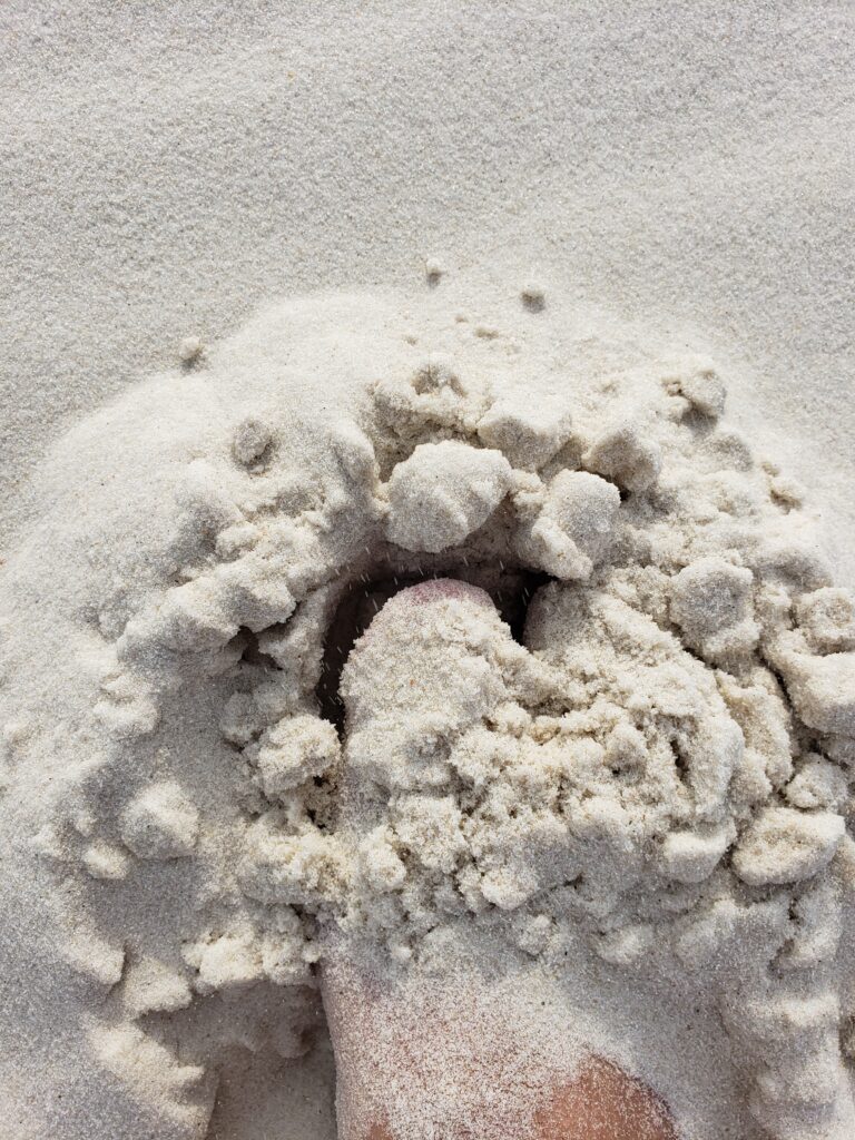
The beach, of course, is sandy, and that sand is deposited by wave action. In the panhandle, the sand comes from quartz that has eroded and washed down rivers from the Appalachian mountains – a process that continues today. This is what makes the panhandle beaches such a brilliant white. You may also notice that sometimes the sand squeaks as you walk across the beach; this is another quality of the quartz. You can also see evidence of this quartz along the central ridge of the state in inland scrub habitats.
Beach habitat is harsh. There is no fresh water and the ground is covered twice daily by salt water. While you may occasionally see seaweed that has washed ashore, plants cannot grow on the beach. Nonetheless, life persists. From bacteria living between grains of sand to worms and other burrowing animals, the sand crawls with life. On this trip, we found live shells (including a moon snail and an olive shell) and many crabs, living and dead. Shorebirds feed off of this beach life but do not generally live on the beach.
The dunes are built by wind-blown sand. The first line of dunes is the primary dune, and there may be a system of dunes lining up inland. The second line is the secondary dune, the third is the tertiary dune, etc.
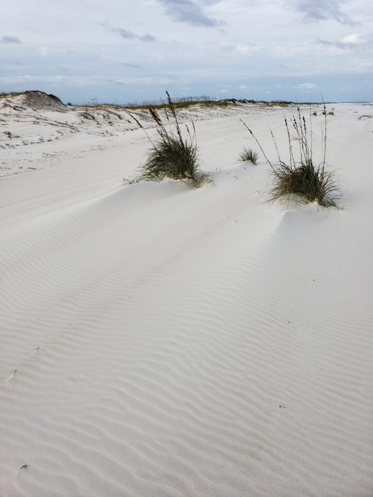
The dune habitat is not much friendlier than the beach, but because dunes get fresh water from rain and may flood during strong storms, they are slightly more welcoming. Sea oats and other grasses grow roots which help hold grains of sand and their leaves catch wind-blown sand and hold it in place. Birds feed on the animals that live in the dunes (small mammals, reptiles, and crabs, for the most part).
The mudflat or overwash zone is created when a large storm or hurricane pushes sediment through the dunes. Because of the nutrients contained in this sediment, grasses are able to grow here and stabilize the mudflat.
Bacteria are hard at work decomposing this mudflat sediment, which contains rich organic material in the form of dead plants and animals. Plankton wash in and out on the tide and feed clams, mussels, and worms. Crabs, including fiddler crabs, ghost crabs and my favorite blue crabs, thrive on the bacteria and small fish and other creatures that live in and wash through the mudflats. These, of course, feed the birds.
Finally the salt marsh is a low area on the lagoon (or sound) side of the barrier island. These marshes are flooded twice a day with the high tides. Some areas of higher land are flooded regularly with the king tides, or perigean spring tides. These tides occur during a new or full moon when the moon is closest to the earth. Because these conditions cause the earth, moon, and sun to be in a straight line, higher than normal tides are created. So — low marsh floods twice a day, and high marsh floods regularly. About half of the salt marshes in the United States can be found along the Gulf Coast.
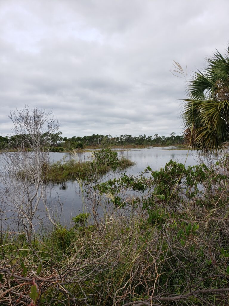
Salt marsh flooding creates a great place for grassesto grow, and the salt marsh is enormously productive in terms of vegetation produced per acre. Decomposing plant matter may be several feet thick! Runoff from the mainland is purified in this coastal filtration system. It may surprise you to think of purification occurring here, especially if you’ve ever smelled the rotten egg smell that is caused by all the bacteria living in low-oxygen conditions. Salt marshes also provide habitat for crustaceans and fish, which find food and great nursery conditions here.
Both nature and development have an impact on barrier islands. Natural forces, like daily tides, periodic storms, and ocean currents, move sand and can shift the island’s location, or create or eliminate barrier islands. Human development can create these same changes, but in a shorter time period. Here is more information on these processes.
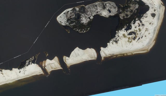
If you are familiar with the Gulf Coast of Florida’s panhandle, this map may be interesting to you. Just south of Naval Air Station Pensacola, you can see the damage done to Perdido Key, where three new inlets were recently created by Hurricane Sally. Below is a photo of that segment of the map.
Knowing the strength of these slender islands makes them even more impressive, and Steve and I want to spend more time exploring the barrier islands of Florida.