
I was surprised at how much there was to see on the two short loop trails that traverse Sweetwater Preserve. The preserve encompasses 125 acres of watershed along both sides of Sweetwater Branch Creek, a waterway that flows out of downtown Gainesville.
The Creek
If you look at a map of Sweetwater Branch, it is obvious that the natural water flow has been changed so that the creek now flows in very straight lines. Because of this and the fact that the creek flows through areas that were once landfills, Sweetwater Wetland Park has been developed to treat this very dirty surface water using natural processes — Sweetwater Preserve is just upstream from Sweetwater Wetland Park. This improved water eventually flows into Paynes Prairie, where it is further filtered by many plants before it enters the Floridan aquifer.

When you look at maps for these trails, you will notice two distinct loops: the East Loop and the West Loop. We started at the West Loop, parking at the end of SE 16th Avenue. There is not a parking lot and there are no restrooms here. The trailhead is clearly marked, though, and it was shady. It was very hot, so the shade was welcome.
West Loop
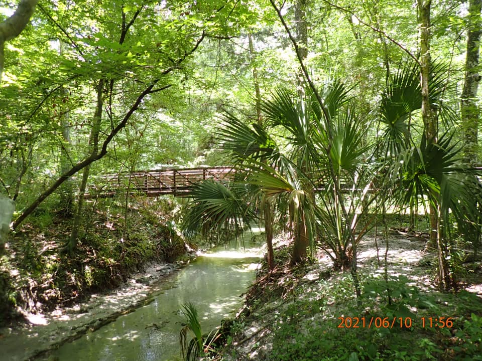
The West loop was, to my way of thinking, a hot mess. The trail was not clearly marked and appeared to cross over itself many times. The only part I felt confident about was the northeast part of the trail that closely followed Sweetwater Branch Creek. But the creek was beautiful (in spite of being terribly polluted by its travels through former landfills) and looked like a spring run, the plants were beautiful and the light filtering through the trees was relaxing, so I’d come back if given the chance. If you go, watch out for poison ivy…it’s everywhere on this loop.

A very nice footbridge crosses the creek and joins the West loop to the East. And, oh, that East loop!
East Loop
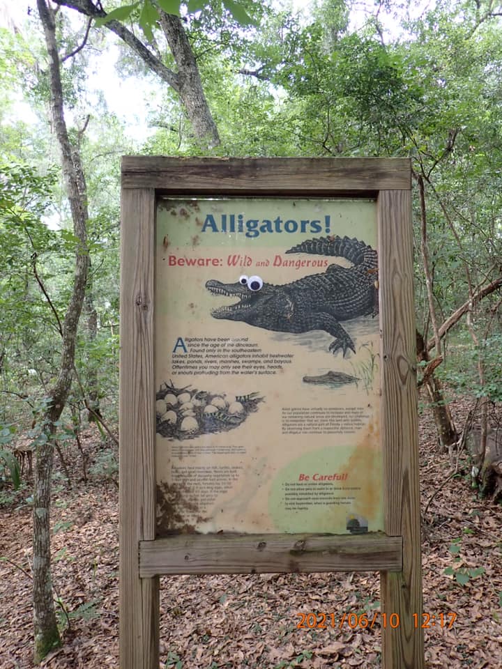
The trail on the East loop is very well marked, and the numbered posts matched the map we had found online. We stopped at the sinkhole pond to cool off and enjoy a short break. While there, we admired the googley eyes someone has placed on the informational kiosk. There are not many kiosks that cannot be improved by the judicious application of googley eyes. We listened to a bullfrog calling for friends, adjusted our packs, and walked on.
The trail feels longer than the listed 1.2 miles, and travels through numerous habitats, including sandhill, hammocks, the sinkhole lake, baygall (shallow wetlands), seepage stream, upland and floodplain forests, and mesic flatwoods.
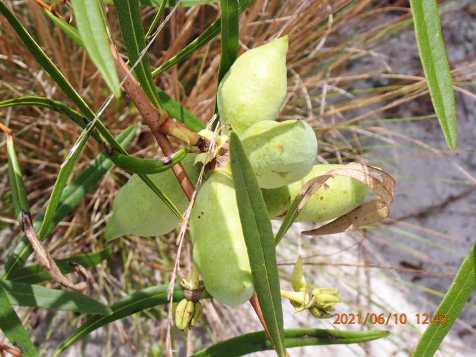
Way Down Yonder in the Pawpaw Patch
It was along this trail that I finally got to see a pawpaw that was bearing fruit. My family used to sing a little song about pawpaws, and so ever since I was a little girl, I’ve wanted to see a pawpaw. I’ve managed to find the plants, and I frequently see them blooming in the spring, but this was the first time I’ve seen the fruit. They were not ripe, but I broke one open to see the inside. It looks like they would be pulpy with large seeds. Maybe I can go back and find out!
Once water from this preserve leaves on the downstream flow, it enters Sweetwater Wetlands Park. In this park, the sheetwater flow of Sweetwater Branch is being restored to a more natural state. As it flows across the park, it is also cleaned up before it hits Paynes Prairie. I hope to see this park next time I’m in the area. Maybe it will be as impressive as Orlando Wetlands Park. These projects create not only cleaner water, but opportunities for all of us to appreciate how resilient nature can be if we get out of the way.
